Before the County Line: Older Ways of Dividing a Region
Learn how to read older county boundaries by checking a map’s date, purpose and legend, and distinguish historical divisions from present-day rules.
Older county boundaries can explain why a village carries one historic label while appearing in a different present-day district. To read an older county boundary accurately, identify what the line represented, when it was drawn and which question you need answered now.
Boundary types
A boundary can mark a physical feature, a jurisdiction or a customary division. A ridge or stream may help describe a territory, but it is not automatically an official limit. A jurisdictional boundary marks where an authority’s responsibilities apply; a customary boundary may instead reflect shared use or local understanding.
Older territorial divisions could be linked to a settlement, religious institution, landholding or local administration. Their edges might follow a natural feature in one place and a written description or convention in another. A later county boundary could absorb, redraw or cross these earlier territories.
When you meet an old place name or line, ask what kind of division it denotes before treating it as a current service area.
Overlapping territories
Administrative change rarely erases every earlier division. Parish, township, estate and other local territories may persist as names or community identities after their original function has changed. Some remain visible on the ground; others survive mainly in documents.
A village can therefore belong to one historic district in a local account and fall within a different county or service jurisdiction on a current map. Both descriptions may be accurate if they refer to different periods or purposes.
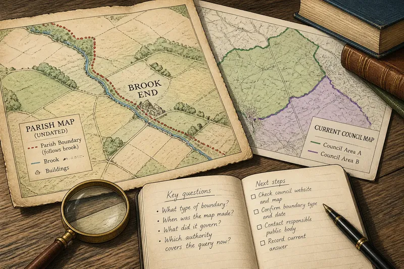
Imagine a hamlet whose old parish boundary follows a brook, while a later county line crosses nearby fields. If a history uses the parish name, it identifies the account’s historical frame; it does not establish which authority handles a present-day matter.
Older boundary questions?
Does an old district name mean its boundary still applies?
Not necessarily: a name may remain in local speech or historical writing after its administrative role has changed. Look for a date and an explanation of what the division governed.
Why do maps show different lines?
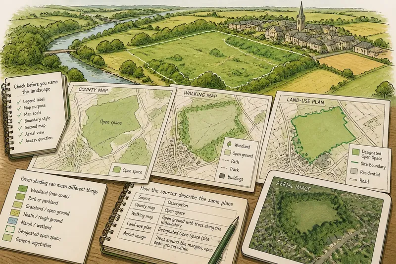
Maps may represent different dates, purposes or types of territory. Compare their legends and publication context before deciding that one line corrects another.
Can a natural feature establish an official limit?
A stream or ridge may have been used to describe a boundary, but the feature alone cannot show whether the line remains official. Historical documents and current authoritative mapping answer different questions.
Check a current boundary?
For a present-day administrative or service question, start with the website and current mapping of the council or other responsible public body. Check that the map names the relevant boundary type and is current enough for your question; an old atlas provides historical context, not a substitute for present information.
- Check the map’s title and date; if it is historical or undated, use it for context and seek a current source for today’s boundary.
- Check the legend for the line type; if it marks a parish or estate rather than the authority you need, find a map showing the relevant administrative or service area.
- Check which place and question the map covers; if it does not identify the service or jurisdiction at issue, ask the responsible public body for the appropriate boundary information.
- Check whether the public body identifies itself as responsible for the area; if the map leaves this unclear, contact the body rather than inferring responsibility from an older place name.
- Check any boundary description against the map; if the two appear to conflict, ask the authority to clarify which current source applies.
- Check whether the answer affects a formal matter such as property or official correspondence; if it does, seek guidance from the relevant public body or a qualified professional instead of relying on a historical map.
Say you are trying to find which council handles a query about a hamlet called Brook End. You have an undated parish map whose key labels the brook as a parish edge, and a current council map that shows council areas but does not name the hamlet. First, the parish map establishes a historical parish division, not the current council limit. Next, because the current map does not identify Brook End, you avoid assigning it to a council by tracing the old parish line. You contact the relevant public bodies with the place name and ask which one covers the query. The resulting answer is a current service-area clarification; the parish map remains useful for understanding the hamlet’s history.
Trace each source
Confusion often starts when a map is separated from its date, legend or purpose. An estate map may show land controlled by an owner, a parish map may mark a local or religious division, and an administrative map may show a jurisdiction. Similar-looking lines do not make these territories interchangeable.
Read the title and key, then look for terms such as “parish”, “hundred”, “ward”, “manor” or “district”. Their meanings vary by place and period, so do not assume that a label carried the same powers everywhere. A line enclosing land does not, by itself, show whether it concerned worship, taxation, ownership, justice or another responsibility.
If a source is undated, treat its boundary as evidence of how territory was represented, not proof of a precise historical arrangement. A later map may retain an old name while simplifying or omitting the original line.
History and current rules
Historical boundaries help explain how people described and organised a region; current rules belong to the authorities operating now. That distinction matters when a boundary question affects services, official correspondence or property. The right answer depends on the specific question and responsible authority, not simply on which older territory feels familiar.
For historical understanding, compare sources that state their period and purpose. For a current administrative question, use information from the responsible authority. If a formal determination matters, seek guidance from the relevant public body or a qualified professional rather than inferring an answer from an old map.
Keep separate notes on what a boundary meant in its own time and what you need answered now. That lets an older county boundary illuminate local history without asking it to settle a present-day question.
Read the county line
People and institutions divided territory before the county line, and those earlier divisions could overlap and endure as names, memories or documentary traces. To read them well, identify their purpose, date and source before connecting them to a present place.
When an old label appears to contradict a current map, ask which boundary each describes. For a practical question, check the current county boundary or service area with the responsible authority; the historical map explains the past, while the current source answers the present-day question.